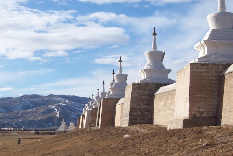
The Capital of the Mongol Empire Is Mapped for the First Time
Karakurum, the 13th-century capital of the Mongol Empire, continues to exist with its remains. However, the physical presence of this ancient city was ignored by historians for a long time. Until now, records of European pilgrims were used to depict this city, which is now located in Central Mongolia.
In other words, archaeologists now need to update their knowledge of Karakurum. In a recent study, researchers used advanced geophysical methods to make a detailed map of the capital for the first time. The findings, published in the journal Antiquity, allowed researchers to unearth new information about this abandoned Eurasian city.
(Who were the Mongols who built the Second Largest Kingdom?)
The establishment of the settlement dates back to 1220, when Genghis Khan established his dormitories in this region of the Orhun River valley, which borders the vast meadows. Cengiz Khan, who became famous for being a capable commander and combining nomadic steppe lengths under one flag, realized the strategic potential of the place where he was camping.

After genghis Khan’s death in 1227, his son and successor, Ögeday, made the same region the capital of the empire. Later, in the place known as Karakurum, the magnificent palace built by Ögeday and the inns that followed him; it was home to diplomats, merchants, Chinese artists, Muslim traffickers and other Silk Road travelers.
The study’s lead author, archaeologist Jan Bemmann of the University of Bonn, and his team worked for 52 days to map 465 hectares of land with a superconducting quantum interference device. The team then combined aerial photographs, historical records and previous studies with the data they obtained to obtain detailed information about the breadth and structure of Karakurum.
According to Bemmann, the new map gives researchers the opportunity to see where large brick buildings once stood and where roads pass. The team was also able to locate elite neighborhoods within city walls.
“The biggest benefit of our project is that this abandoned city reveals its plan in unique detail, both from above and underground,” Bemmann said.
Older research on karakurum was mostly confined to the inner city walls. However, Bemmann’s team said: “We are not going to be able to do that. He discovered that the Orhun Valley of the Mongolian capital had spread much deeper than previously thought. Supply settlements, production sites, housing and other networks were spread throughout the region. “I mean, we’re not just talking about an imperial city, we’re talking about an imperial valley,” Bemmann says.
William of Rubruck, a Flemish Franciscan monk, visited Karakorum in 1254 and wrote about his travels. According to the University of Washington, William’s writings constitute the earliest detailed record of the Mongol Empire through a Westerner’s eyes.
William; He was fascinated by the splendor of the great palace in Karakorum. What impressed the monk the most was the huge silver fountain in the shape of a tree standing at the entrance of the palace. Servants, when commanded, used this fountain to distribute wine, kumiss, honey drink, and rice wine.
Karakorum owed its wealth to the military might of the Mongol Empire, as Ruth Schuster of Haaretz explains, “The warriors brought everything they could from the lands they had conquered: everything from talent to loot.” Bemmann states that the Mongols gathered the “best people” in Central Asia and brought them to the center of the Mongolian realm, where they forced them to contribute to the construction and growth of the city.
“The Mongols were really nomadic and remained nomadic,” says Bemmann. “They wouldn’t build cities,” so they needed the help of prisoners. Interestingly, 40 percent of the space within the walls of karakurum city was completely empty.
Karakurum was abandoned in the 15th century. Experts discovered the location of the city in 1889, but in the following decades little archaeological work was carried out in the area.
“It was unique to witness the day-to-day expansion of the map and the digital reconstruction of Karakurum,” Bemmann adds. “With each passing day, every little detail added to the map increased our knowledge of the city.”
Bemmann, J., Linzen, S., Reichert, S., & Munkhbayar, L. (2021). Mapping Karakorum, the capital of the Mongol Empire. Antiquity, 1-20.

