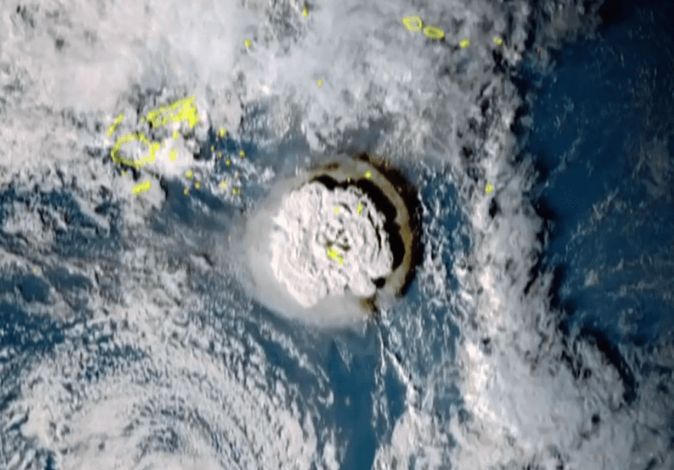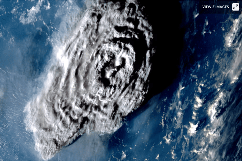
The exact size of the enormous explosion off the coast of Tonga earlier this year was revealed by new study, which also confirmed that the plume from the eruption was the biggest ever recorded. As the mesosphere begins at a height of about 50 km, it is also the first one to be seen extending through lower layers of the atmosphere to enter it (31 miles).
The Hunga-Tonga Hunga-Ha’apai eruption, which occurred on January 14 to the north of Tonga, is recognized as one of the most powerful eruptions ever recorded. The explosion sent shockwaves throughout the globe and unleashed terrible tsunamis across the Pacific.
Geostationary weather satellite footage has been used by researchers at the University of Oxford to acquire a fresh perspective on the incident. These satellites examined the volcano from three different perspectives and took a series of pictures at 10-minute intervals to show the eruption plume.
The researchers then employed a cutting-edge measurement method based on the parallax effect, which is the phenomenon in which a subject’s position appears to change when viewed from different angles (hold your thumb out in front of you and close either eye alternatively to get the idea). The team was able to determine the distance to the plume by measuring these apparent changes in the subject’s position and using the known separation between the satellites as a reference.
The analysis showed that it reached an altitude of 57 km (35 miles) at its highest point, a great deal taller than the 40-km-high (25-mile) plume ejected from Mount Pinatubo in 1991. This also makes it the first volcanic eruption to carry material through the troposphere and stratosphere, to inject it directly into the mesosphere.

“It’s an extraordinary result as we have never seen a cloud of any type this tall before,” said lead author Dr Simon Proud. “Furthermore, the ability to estimate the height in the way we did (using the parallax method) is only possible now that we have good satellite coverage. It wouldn’t have been possible a decade or so ago.”
Based on these results, the scientists now plan to develop an automated tool for calculating the heights of volcanic plumes through the parallax method.
“We’d also like to apply this technique to other eruptions and develop a dataset of plume heights that can be used by volcanologists and atmospheric scientists to model the dispersion of volcanic ash in the atmosphere,” said co-author Dr Andrew Prata. “Further science questions that we would like to understand are: Why did the Tonga plume go so high? What will be the climate impacts of this eruption? And what exactly was the plume composed of?”
The research was published in the journal Science.