The search and rescue operation launched after the sinking of the ship “Batuhan A”, which departed from Marmara Island of Balıkesir with a crew of 6 people, off the coast of Karacabey district of Bursa, continues with 275 personnel.
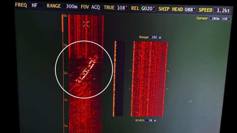
Naval Forces Command and Coast Guard Command identified the area where the ship was located at a depth of 51 meters.

Search and rescue teams intensified their work in the area where the image of the wreck was taken with underwater scanning devices.
The cargo ship named “Batuhan A”, which departed from Balıkesir’s Marmara Island to Roda Port in Bursa’s Gemlik district, sank off the coast of Karacabey district due to heavy weather and sea conditions, and the teams dispatched to the region found an empty life raft in the area where the ship was considered to have sunk.
